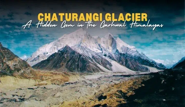
Chaturangi Glacier is one of the most beautiful and lesser-known glaciers in the Indian Himalayas. Located in the Garhwal region of Uttarakhand, this glacier lies in the Gangotri National Park, near the famous Gangotri Glacier. The name “Chaturangi” means “four-colored,” which refers to the colorful hues seen in the glacier due to different types of ice and surrounding rocks.
This glacier is an important source of the Bhagirathi River, one of the main headstreams of the holy Ganga (Ganges) River. Chaturangi is also a favorite among high-altitude trekkers, glaciologists, and adventure lovers.
Why Visit Chaturangi Glacier?
Chaturangi Glacier is not just a chunk of ice – it is a magical journey through untouched beauty, high mountain passes, and spiritual landscapes. Here’s why you should add it to your bucket list:
1. Unexplored Natural Beauty
Unlike crowded tourist destinations, Chaturangi Glacier remains untouched. Its unique four-colored ice gives it an unreal and dreamy appearance.
2. Adventure Trekking Experience
If you love trekking, this trail will test your endurance and offer breathtaking views of snow-covered peaks like Mt. Shivling, Bhagirathi I, II, and III, and Mt. Satopanth.
3. Spiritual Surroundings
The glacier lies close to Gaumukh, the snout of the Gangotri Glacier and a holy site for Hindus. Pilgrims and spiritual seekers also travel along this route.
Location and Geography
-
Region: Uttarkashi District, Uttarakhand, India
-
Altitude: Around 5,000 meters (16,404 feet) above sea level
-
Part of: Gangotri Glacier System
-
Coordinates: Approx. 30.98°N, 79.08°E
Chaturangi Glacier originates from the southwestern slopes of the Chaukhamba group of peaks. It merges with the Gangotri Glacier and finally contributes to the Bhagirathi River.
How to Reach Chaturangi Glacier
Step 1: Reach Gangotri
-
By Road: Gangotri is well connected by road from Dehradun, Rishikesh, and Haridwar.
-
By Train: The nearest railway station is in Rishikesh (250 km approx. from Gangotri).
-
By Air: The closest airport is Jolly Grant Airport, Dehradun.
Step 2: Gangotri to Bhojwasa (Trek Start Point)
From Gangotri, start trekking towards Bhojwasa (approx. 14 km). This part is moderately challenging and offers river crossings, forests, and meadows.
Step 3: Bhojwasa to Gaumukh
Continue to Gaumukh (4 km), the sacred source of the Ganges.
Step 4: Gaumukh to Chaturangi Glacier
The final trek of around 7-8 km leads to the Chaturangi Glacier. This stretch is steep, icy, and requires proper gear.
Chaturangi Glacier Trek Details
| Feature | Details |
|---|---|
| Best Time to Visit | May–June and September–October |
| Trek Duration | 7–10 days (round trip) |
| Difficulty Level | Moderate to Difficult |
| Total Trek Distance | Around 40–50 km |
| Camping Sites | Bhojwasa, Tapovan, Nandanvan |
| Permits Required | Yes, from Forest Department & IMF |
| Guide Requirement | Mandatory for safety |
Trekking Tips for Chaturangi Glacier
-
Acclimatize properly before starting the trek to avoid AMS (Acute Mountain Sickness).
-
Carry warm clothes, sturdy trekking boots, trekking poles, and first aid.
-
Bring enough dry fruits, energy bars, and water.
-
Take help from local trekking agencies or certified guides.
-
Always respect the mountain ecosystem – avoid plastic, don’t litter, and preserve nature.
Nearby Attractions to Explore
When visiting the Chaturangi Glacier, you’re not just seeing a glacier — you’re entering a region filled with natural beauty, spiritual energy, and high Himalayan charm. Here are some top nearby attractions you should not miss:
1. Gaumukh Glacier
Distance from Chaturangi: Approx. 7–8 km
Why Visit:
Gaumukh is the source of the holy Ganga River, making it one of the most sacred sites in India. The name “Gaumukh” means “cow’s mouth” because the snout of the glacier looks like one. It is a popular destination for pilgrims and trekkers alike.
Highlights:
-
Spiritual bathing point
-
Peaceful atmosphere
-
Base camp for longer glacier treks
2. Gangotri Temple
Distance from Chaturangi Glacier (via Gangotri): Approx. 18–20 km
Why Visit:
One of the Char Dham temples of Uttarakhand, the Gangotri Temple is dedicated to Goddess Ganga. Every year, thousands of pilgrims come here to offer prayers and start their spiritual journey toward the Himalayas.
Highlights:
-
Open from May to October
-
Historical and spiritual importance
-
Scenic setting along the Bhagirathi River
3. Tapovan
Distance from Gaumukh: Approx. 5–6 km
Why Visit:
Tapovan is a high-altitude alpine meadow, known for its stunning views of Mount Shivling and the Bhagirathi peaks. It is ideal for meditation, yoga, photography, and camping under the stars.
Highlights:
-
Towering Himalayan views
-
Rich flora and fauna
-
Perfect for silence and inner peace
4. Nandanvan
Distance from Tapovan: Approx. 7 km
Why Visit:
Nandanvan is another beautiful meadow surrounded by glaciers and towering mountains. It lies close to the Bhagirathi Glacier and offers mesmerizing views of Mount Kedardome and Bhagirathi I, II, III.
Highlights:
-
Glacier views
-
Great for camping and high-altitude photography
-
Base for advanced mountaineering expeditions
5. Bhojwasa
Distance from Gangotri: Approx. 14 km
Why Visit:
Bhojwasa is a popular overnight stop for trekkers heading to Gaumukh and Chaturangi Glacier. The place is surrounded by birch trees (bhojpatra) and offers basic accommodation, tenting, and food.
Highlights:
-
Ideal campsite
-
Sunset views over Mount Shivling
-
Peaceful setting for nature lovers
6. Kedartal
Distance from Gangotri: Approx. 17 km (different trekking route)
Why Visit:
One of the most beautiful glacial lakes in Uttarakhand, Kedartal sits at an altitude of 4,750 meters. It is a challenging but rewarding trek from Gangotri and perfect for adventure seekers.
Highlights:
-
Pristine lake with mountain reflections
-
Stunning views of Mount Thalay Sagar and Brighupanth
-
Less crowded, offbeat destination
7. Harsil Valley
Distance from Gangotri: Approx. 25 km (by road)
Why Visit:
Harsil is a serene valley on the banks of the Bhagirathi River, surrounded by deodar forests and snow-capped peaks. It’s a perfect place to relax after a challenging trek.
Highlights:
-
Apple orchards
-
Calm river views
-
Peaceful village life
Why is Chaturangi Glacier Important?
-
It plays a vital role in feeding the Bhagirathi River.
-
It supports the Himalayan ecosystem and biodiversity.
-
It is a key indicator of climate change in the Indian Himalayas.
-
It adds to the spiritual, cultural, and adventure tourism value of Uttarakhand.
Environmental Concerns
Due to global warming, many glaciers, including Chaturangi, are retreating at an alarming rate. According to studies by glaciologists, the Chaturangi Glacier has been receding over the past few decades. Responsible trekking and climate awareness are essential to protect this natural wonder.
Chaturangi Glacier Trek Itinerary
Day 1: Reach Gangotri
Day 2: Acclimatization and local exploration
Day 3: Trek to Bhojwasa
Day 4: Trek to Gaumukh
Day 5: Trek to Chaturangi Glacier and camp
Day 6: Explore the glacier and nearby areas
Day 7: Return to Gaumukh/Bhojwasa
Day 8: Trek back to Gangotri
Conclusion
Chaturangi Glacier is not just a destination – it’s an experience that combines natural wonder, spiritual peace, and thrilling adventure. Whether you are a passionate trekker, a nature lover, or someone looking to explore the hidden parts of India, the Chaturangi Glacier trek will leave you inspired and amazed.
Make sure to plan wisely, travel responsibly, and support local eco-tourism to keep this Himalayan beauty alive for future generations.
FAQs about Chaturangi Glacier
Q1: Is Chaturangi Glacier trek safe?
Yes, but it is recommended for experienced trekkers. Proper preparation, guides, and permits are necessary.
Q2: Do I need permission to visit Chaturangi Glacier?
Yes, you need a trekking permit from the Forest Department and Gangotri National Park authorities.
Q3: Can beginners do the Chaturangi trek?
It is not advisable for first-time trekkers. The high altitude and glacier conditions require good fitness.
Q4: What’s special about the name Chaturangi?
“Chatur” means four and “Rangi” means colored. The glacier shows four distinct shades, making it unique.
Q5: Which is the best month for the trek?
The months of May to June and September to October are ideal, as the weather is clear and trails are accessible.