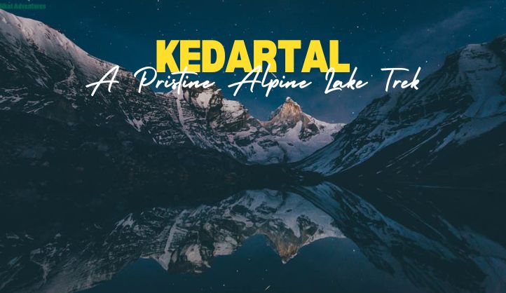
In the lap of the majestic Garhwal Himalayas, Kedartal is a high-altitude glacial lake located at an elevation of approximately 4,750 meters (15,580 feet) above sea level. This pristine and picturesque lake is revered for its crystal-clear waters and mesmerizing surroundings. Kedartal, also known as Shiva’s Lake, holds immense spiritual significance and is one of the most challenging and rewarding trekking destinations in Uttarakhand, India.
Location and Geography
Kedartal is situated in the Uttarkashi district of Uttarakhand and lies in the shadow of towering Himalayan peaks such as Thalay Sagar (6,904 meters), Brigupanth (6,772 meters), Jogin I, and Jogin II. It is formed by the melting glaciers of these peaks and serves as the origin of the Kedar Ganga River, which flows down to meet the Bhagirathi River at Gangotri. The lake’s glacial waters are surrounded by rugged terrain, rocky landscapes, and alpine meadows, making it a destination of untouched beauty and tranquility.
The Kedartal Trek
Kedartal is a challenging trek, best suited for experienced trekkers due to its steep and rugged trails, high altitude, and unpredictable weather. The trek begins from Gangotri, one of the Char Dham pilgrimage sites, and spans approximately 17 kilometers (one way) to reach the lake. The trek usually takes 5 to 6 days, allowing trekkers to gradually acclimatize to the increasing altitude.
Key Highlights of the Trek:
- Gangotri Temple: The journey to Kedartal begins at Gangotri, a significant pilgrimage site dedicated to Goddess Ganga. Trekkers can pay their respects at the ancient temple before embarking on the trek.
- Bhoj Kharak: The first major campsite on the Kedartal trek, Bhoj Kharak, is located at an altitude of around 3,780 meters. The trail to Bhoj Kharak passes through dense forests of birch and pine trees, offering scenic views of the Bhagirathi River.
- Kedar Kharak: The second campsite, Kedar Kharak, is situated at 4,300 meters and offers stunning views of the surrounding peaks. The trek from Bhoj Kharak to Kedar Kharak is steep, with rocky terrain, but the sight of the majestic mountains makes the effort worthwhile.
- Stunning Views: As trekkers make their way to Kedartal, they are rewarded with breathtaking views of some of the most iconic peaks of the Garhwal Himalayas. The towering Thalay Sagar and Brigupanth stand out, creating a dramatic backdrop.
- Kedartal Lake: The ultimate reward is the serene and mesmerizing Kedartal itself. The clear blue waters of the lake reflect the surrounding snow-clad peaks, creating a picture-perfect scene. The tranquil atmosphere and the sheer beauty of the lake make it a once-in-a-lifetime experience for trekkers.
Flora and Fauna
The Kedartal region is rich in Himalayan flora and fauna. The lower sections of the trek are adorned with forests of oak, pine, and birch, while higher altitudes feature alpine meadows dotted with rare wildflowers during the summer months. Wildlife enthusiasts may spot animals like blue sheep (bharal), snow leopards, Himalayan black bears, and a variety of Himalayan birds.
Best Time to Visit
The best time to undertake the Kedartal trek is from May to June and September to October. During these months, the weather is relatively stable, and the skies are usually clear, offering excellent visibility of the surrounding peaks. Monsoon months (July and August) are best avoided due to landslides and slippery trails. Winters bring heavy snowfall, making the trek inaccessible.
Spiritual Significance
Kedartal holds immense religious and spiritual significance for Hindus. It is believed to be the source of the Kedar Ganga, considered to be the holy water of Lord Shiva. According to Hindu mythology, the Kedar Ganga stream was gifted to Bhairava (a fierce form of Lord Shiva) as a boon. Pilgrims and trekkers alike consider Kedartal a sacred site, and many visit to seek divine blessings and immerse themselves in the serenity of nature.
Essential Information for Trekkers
- Permits: Trekkers require permits from the Gangotri National Park authorities to access the Kedartal trek. It is advisable to check with local authorities or trekking agencies for updated permit requirements.
- Fitness and Preparation: Given the high altitude and challenging terrain, trekkers need to be in good physical condition. Prior experience in high-altitude trekking and a gradual acclimatization process is essential to avoid altitude sickness.
- Guides and Porters: Hiring an experienced guide is highly recommended for the Kedartal trek. Local guides have in-depth knowledge of the terrain and weather conditions. Porters can also be hired to assist with carrying gear.
- Camping and Equipment: Since there are no accommodations along the Kedartal trek, trekkers need to carry their own camping gear, including tents, sleeping bags, and food supplies. It is important to pack appropriately for the cold and unpredictable mountain weather.
Nearby places to explore
Gangotri
Distance from Kedartal Trek Base: ~17 km (starting point of the Kedartal trek)
Gangotri is one of the Char Dham pilgrimage sites and a significant spiritual destination. The Gangotri Temple, dedicated to Goddess Ganga, is a major attraction. The surrounding area offers scenic views of the Bhagirathi River and nearby peaks.
Gaumukh Glacier
Distance from Gangotri: ~18 km
Gaumukh Glacier is the source of the holy Ganges River and is one of the most sought-after trekking destinations in the region. It lies at the base of the Bhagirathi peaks and offers a breathtaking view of the glacier’s snout, where the river emerges.
Nandanvan
Distance from Gaumukh: ~6 km
Located on the opposite side of Tapovan, Nandanvan is another alpine meadow offering a closer view of Mount Shivling and Mount Meru. It serves as a base for mountaineers and is surrounded by glaciers and rivers.
Harsil
Distance from Gangotri: ~25 km
Harsil is a serene and scenic village situated on the banks of the Bhagirathi River. Known for its unspoiled beauty, apple orchards, and forests of pine and deodar, Harsil is a peaceful retreat for nature lovers. The village also offers stunning views of the surrounding mountains.
Dharali
Distance from Gangotri: ~20 km
A quiet hamlet near Harsil, Dharali is famous for its apple orchards and scenic landscape. It’s a great place to explore the rustic charm of Himalayan villages and enjoy the tranquility of the mountains. The village is also home to the Mukhba Temple, the winter abode of Goddess Ganga.
Bhaironghati
Distance from Gangotri: ~10 km
Located near the confluence of the Jadh Ganga and Bhagirathi Rivers, Bhaironghati is famous for the Bhairav Temple, dedicated to Lord Bhairav, a fierce form of Lord Shiva. The area also offers picturesque views of the rugged terrain and the rivers.
Dayara Bugyal
Distance from Gangotri: ~40 km
One of the most beautiful alpine meadows in Uttarakhand, Dayara Bugyal is located near Uttarkashi. The vast, rolling meadows offer stunning views of the surrounding Himalayan ranges and are a great spot for trekking, camping, and skiing in winter.
Sat Tal
Distance from Harsil: ~7 km
Not to be confused with the Sat Tal near Nainital, this Sat Tal is a group of seven freshwater lakes located near Harsil. It is a serene and lesser-known destination, perfect for nature walks and birdwatching.
Conclusion
Kedartal is a hidden gem in the Garhwal Himalayas, offering a unique blend of adventure, spirituality, and natural beauty. For those seeking an off-the-beaten-path trekking experience, this pristine lake and its surrounding peaks provide a truly unforgettable journey. The Kedartal trek is not just a test of endurance but also an opportunity to witness the breathtaking grandeur of the Himalayas and immerse in the peaceful ambiance of one of Uttarakhand’s most stunning landscapes.
FAQs
How difficult is the Kedartal trek?The Kedartal trek is considered challenging due to its steep ascents, high altitude, and rugged terrain. It is best suited for experienced trekkers with prior high-altitude trekking experience.
When is the best time to visit Kedartal?The ideal time to visit Kedartal is from May to June and September to October when the weather is stable, and the skies are clear.
Do I need a guide for the Kedartal trek?Yes, it is highly recommended to hire a local guide for the Kedartal trek, as the terrain is challenging, and local expertise is crucial for navigating the trails.
What is the altitude of Kedartal?Kedartal is located at an elevation of approximately 4,750 meters (15,580 feet) above sea level.
What should I pack for the Kedartal trek?Trekkers should pack essential gear, including warm clothing, camping equipment, trekking poles, and high-altitude trekking shoes. A good sleeping bag and tent are also necessary.